Important Forest Corridor for Gorillas under Threat
Categories: Journal no. 37, Threats, Nigeria, Afi, Mbe, Cross River Gorilla, Gorilla Journal
The Afi River Forest Reserve is an area lying between two sites in Nigeria where the Cross River gorilla is known to occur - the Afi Mountain Wildlife Sanctuary (AMWS) and the Mbe Mountains. This reserve is one of the largest remaining forest blocks in Cross River State outside of the near-by Cross River National Park and covers approximately 380 km² at the head waters of the Afi River in the northern part of Cross River State. The AMWS, contiguous to the reserve, is known to be inhabited by a small sub-population of the Cross River gorilla (Gorilla gorilla diehli). To the east of the reserve, Cross River gorillas can be found in the Mbe Mountains and in the Okwangwo Division of the Cross River National Park where two other gorilla groups are known to occur, but the Afi sub-population is in danger of becoming isolated from these.
The large Afi River Forest Reserve is an area of lowland forest and ridge forest that is thought to be rarely used by gorillas. In comparison, the AMWS and the Mbe Mountains have received relatively more conservation attention. In fact, the AMWS was created from the northwestern corner of the reserve, and was gazetted as a wildlife sanctuary (the AMWS) in 2000 for the protection of the westernmost sub-population of Cross River gorilla. This sanctuary also protects other endangered primate species, including the Gulf of Guinea Chimpanzee, and the drill. The Mbe Mountains also enjoy an increased level of protection via a community-based conservation initiative supported by the Wildlife Conservation Society (WCS) in Nigeria (see Gorilla Journal 30 and Gorilla Journal 36).
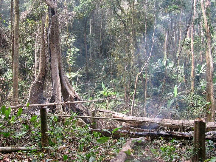
The neglect of the Afi River Forest Reserve, despite its importance as a corridor between the AMWS and the Mbe Mountains, has resulted in an increase in human activities there (such as farming, logging and hunting), and these have altered a considerable portion of the forest and may have isolated the gorillas there. Adding to this isolation of the Afi sub-population of gorillas has been the creation of a paved highway that passes between the Afi and Mbe Mountains. The long-term survival of the Cross River Gorilla in this part of Nigeria will ultimately depend to a large extent on their ability to have regular genetic contact with other gorilla groups, and the Afi River Forest Reserve is an important forest corridor that allows for such inter-group migration; the increase in human activities occurring there has resulted in destruction of some of the remaining forest, and the forest reserve is now seriously threatened.
In recognition of this, four NGOs (WCS, Pandrillus, Fauna and Flora International and Nigerian Conservation Foundation, NCF), working in collaboration with the Cross River State Forestry Commission (CRSFC), decided to conduct the first systematic survey of the Afi River Forest Reserve. Up to that point, there had been no systematic data collection on wildlife abundance or human pressures within the reserve. This lack of reliable up-to-date information meant that objective and effective management within the larger region was difficult. The survey's objectives were:
- to assess the scale and distribution of human activities in the reserve,
- to assess the feasibility of creating a corridor of forest connecting the AMWS to the Mbe Mountains for the long-term conservation of the Afi gorillas,
- to obtain baseline data for monitoring wildlife populations within the reserve,
- to assess the abundance and distribution of selected non-timber forest products and economically important tree species in the reserve.
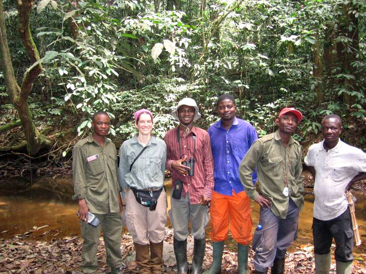
Over a period of 3 months (February to April of 2008), a field team comprised of staff from the CRSFC, WCS, NCF and Pandrillus carried out the survey. Representatives of local communities accompanied the team across guided recce walks that covered a total of 27 transects and 82 km in the reserve.
Starting from the major Ikom-Obudu Highway to the east, and from the Olum-Boje Road to the west, the team travelled through the forest to the Afi River. All evidence of wildlife, farming, logging and hunting along transects was recorded. Additionally, at each 200 m along the recce path, the team made an assessment of the vegetation in 20 m radius plots, allowing for an overall picture of habitat quality throughout the reserve.
Results from the survey showed extremely high levels of farming, logging and hunting activities within the reserve. For example, encounter rates of approximately 3 farms and 3 signs of logging per km within a forest reserve are unquestionably high; such a high encounter rate is a clear indication that, unless concerted conservation action is taken to reverse the current trend, the entire reserve could soon become converted to farmland in the foreseeable future.
The northern part of the reserve appeared to be the most affected; over one third of the reserve, mostly in this northern area, has already been converted to farmland and more forest area is being opened for farming in some of the relatively less disturbed areas, leaving only small patches of forest.
Although human population density around the entire reserve is high and demand for agricultural land and forest products is likewise high, it appears that factors such as the traditional land tenure system, which ascribes ownership of an area of forest to the first community member to clear it, and very weak, almost nonexistent enforcement of forestry and wildlife laws in the reserve have contributed significantly to this extensive encroachment. Many farms located deep inside the reserve (far from human settlements) were reported by local farmers to have been cleared in order to lay claim of ownership on the land even though the land was not actually needed in the short term. In many cases such farms receive very little attention from their owners except few occasional inspection visits to prevent counter claims from other community members.
In contrast to the lack of good tracts of forest in the northern part of the reserve, a substantial tract of relatively good primary forest remains in the southern part. This area could serve as a wildlife corridor if adequately protected, although the prevalence of a relatively high level of logging, as well as hunting evidence, is a serious and immediate threat. In particular, logging activity is now focused where forest resources are relatively abundant, so that even the remaining tracts of relatively good forest in the reserve are under threat of destruction if urgent steps are not taken to discourage further exploitation.
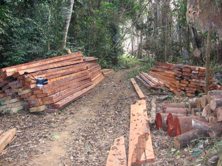
Analyses which looked at the age of logging evidence showed that there has been an increase in logging activities in the last 5 years. Local efforts to stop logging have not been effective: for example, an anti-logging gate constructed on one of the main entrance routes into the reserve by the local law enforcement agency, CRFSC, appears to have had little effect in discouraging illegal logging. A number of large logging roads used by tractors were recorded during the survey.
Although the survey found relatively low levels of hunting in the reserve, wildlife evidence was extremely scarce. Most frequently encountered were three species of duiker (the blue duiker, Philantomba monticola, the bay duiker, Cephalophus dorsalis, and Ogilby's duiker, C. ogilbyi), the red river hog (Potamochoerus porcus), and the African brush-tailed porcupine (Atherurus africanus). Although large species such as the yellow-backed duiker (C. silvicultor) were also recorded during this survey, their continued survival would require urgent anti-poaching measures since their large body size makes them a target for hunters.
The absence of ape and monkey species within the survey area (except for a single record of a distant mona monkey, Cercopithecus mona, vocalization) is a cause for concern. Signs of the larger primates present in this region of Nigeria are fairly easy to recognize and could not have been missed by the survey team made up of people with considerable field experience. Our conclusion is that current hunting pressure might be too high for primates to survive even within the remaining suitable habitat in the reserve.
The results of this survey have drawn attention to the level of habitat disturbance in the Afi River Forest Reserve and have highlighted some important issues regarding the long-term survival of the Cross River gorilla and other primate populations within the AMWS. If action is taken to slow the spread of farms and halt illegal logging, the Afi River Forest Reserve may still serve as a wildlife corridor between the AMWS and the Mbe Mountains. Our results also suggest that the southern part of the reserve offers the best option for a possible wildlife corridor, but continued survival of this forest is not yet assured. Unless the current rate of habitat destruction is reduced, this critical link will be lost. The obvious consequence will be further isolation of the small Cross River gorilla sub-population within the AMWS.
The data from this initial survey have resulted in a number of recommendations for this important corridor area. First and foremost, local law enforcement agencies (in particular the CRSFC with support from relevant local and international NGOs) need to urgently review local enforcement strategies and gain better control over logging and farming activities in the reserve, and preferably to eradicate these activities completely. Next, any efforts to create a wildlife corridor in the reserve connecting the AMWS and the Mbe Mountains should focus on the southern part of the reserve, where most of the remaining relatively undisturbed forest occurs. Additional surveys of this area may be necessary to obtain a more complete picture of the best possible wildlife corridor. Also, a separate survey dedicated to mapping farms in the reserve may be necessary to obtain more detailed information on their nature and extent. Finally, follow-up surveys could be used to monitor any changes.
Inaoyom Imong and Kathy L. Wood


